


Isola Voting District, Humphreys County, Mississippi
About
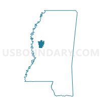
Outline

Summary
| Unique Area Identifier | 605666 |
| Name | Isola Voting District |
| County | Humphreys County |
| State | Mississippi |
| Area (square miles) | 58.87 |
| Land Area (square miles) | 57.72 |
| Water Area (square miles) | 1.15 |
| % of Land Area | 98.04 |
| % of Water Area | 1.96 |
| Latitude of the Internal Point | 33.23459930 |
| Longtitude of the Internal Point | -90.62101910 |
Maps


Graphs
Select a template below for downloading or customizing gragh for Isola Voting District, Humphreys County, Mississippi


Neighbors
Neighoring Voting District (by Name) Neighboring Voting District on the Map
- Central Belzoni Voting District, Humphreys County, MS
- Darlove Baptist Church Voting District, Washington County, MS
- Gooden Lake Voting District, Humphreys County, MS
- Hollandale City Hall Voting District, Washington County, MS
- Indianola 2 West Voting District, Sunflower County, MS
- Inverness Voting District, Sunflower County, MS
- Midnight Voting District, Humphreys County, MS
- North Belzoni Voting District, Humphreys County, MS
- Northwest Belzoni Voting District, Humphreys County, MS
- Southwest Belzoni Voting District, Humphreys County, MS
Top 10 Neighboring County Subdivision (by Population) Neighboring County Subdivision on the Map
- District 5, Washington County, MS (9,476)
- District 1, Sunflower County, MS (5,703)
- District 2, Sunflower County, MS (5,147)
- District 4, Humphreys County, MS (2,338)
- District 2, Humphreys County, MS (1,903)
- District 5, Humphreys County, MS (1,813)
- District 1, Humphreys County, MS (1,618)
Top 10 Neighboring Place (by Population) Neighboring Place on the Map
Top 10 Neighboring Unified School District (by Population) Neighboring Unified School District on the Map
- Sunflower County School District, MS (10,540)
- Humphreys County School District, MS (9,375)
- Hollandale School District, MS (3,750)
Top 10 Neighboring State Legislative District Lower Chamber (by Population) Neighboring State Legislative District Lower Chamber on the Map
- State House District 34, MS (21,017)
- State House District 31, MS (19,331)
- State House District 51, MS (19,142)
Top 10 Neighboring State Legislative District Upper Chamber (by Population) Neighboring State Legislative District Upper Chamber on the Map
Top 10 Neighboring 111th Congressional District (by Population) Neighboring 111th Congressional District on the Map
Top 10 Neighboring Census Tract (by Population) Neighboring Census Tract on the Map
- Census Tract 9503, Humphreys County, MS (4,165)
- Census Tract 9505, Sunflower County, MS (2,999)
- Census Tract 9501, Humphreys County, MS (2,636)
- Census Tract 9502, Humphreys County, MS (2,574)
- Census Tract 9506, Sunflower County, MS (2,571)
- Census Tract 1, Washington County, MS (1,648)